
Filling Lake Powell
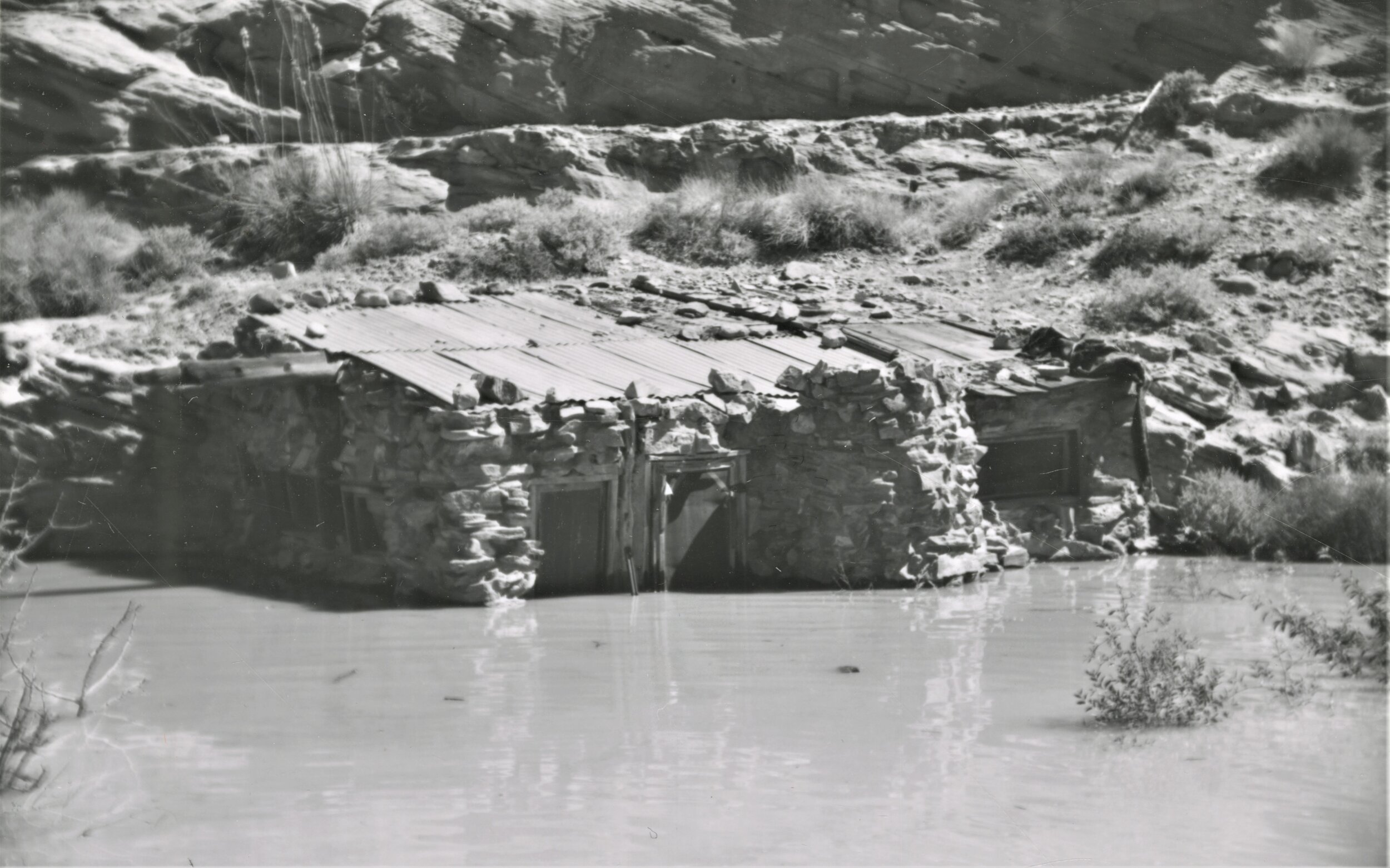
Lake Powell filling around Stone Cabin at Gretchen Bar. May 26, 1963. Gregory Crampton P0197n47_02_062, Special Collections, J Willard Marriott Library, University of Utah
Approximate lake level elevation: 3425 feet above sea level
It took 27 years to fill the controversial reservoir to an elevation of 3700 feet above sea level. Hailed by some as the “jewel of the Colorado” while others call it the greatest environmental disaster in the West, Lake Powell became a water savings account of the upper basin states.
Lake Powell inundated an immeasurable amount of natural resources: canyons, sandstone buttes, cultural sites, and miles of river corridors. It was called “the place no one knew” and the argument that “there is nothing out there” was frequently used.
One of the beauties of Colorado Plateau country is that the desert holds its secrets close to its chest. This means that places existed there that no one will ever see.
What is known is that the reservoir would be approximately 186 miles long and it would cover an area of 255 square miles in a catchment area of 108,335 square miles.
When full, the reservoir inundated 186 miles of the Colorado River, 60 miles of the San Juan River, 24 miles of the Escalante River, and an unknown amount of tributary side canyons.